preloader

Cycling trails

LAND OF SMALL LAKES

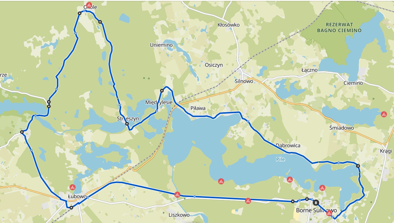
The route of the trail: Borne Sulinowo – Piława River near Liszków – Łubowo – Rakowo – Lake Rakowo – Lake Komorze – Okole – Strzeszyn – Piława River – Międzylesie – Piława – Silnowo (Dolne) – Dąbrowica – Krągi – Borne Sulinowo.

The length of the trail is 45.3 km.

The bicycle trail is marked with a white square with a black silhouette of a bicycle in the upper part and a black rectangle in the lower half.

Instead of a rectangle, a black arrow is placed before the change of direction. The starting and ending points of the trail are marked with a black circle on a white background.

The black "Land of Small Lakes" cycling trail begins and ends at the junction of three municipal cycling trails, located in the tree-lined square in front of the town hall in Borne Sulinowo. The trail leads to the "Land of Small Lakes," stretching between the villages of Rakowo, Komorze, Okole, Uniemino, and Strzeszyn. This area is saturated with small, post-glacial lakes hidden within the pine forest complex.
2023-year-Land-of-small-lakes-black-bicycle-trail

LAND OF THE INVERTED CROSS

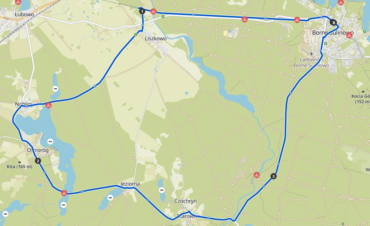
Route: Borne Sulinowo – Starowice – Czochryń – Lake Czochryńskie – Jeziorna – Lake Kortkowo – Ostroróg – Nobliny – Liszkowo – bridge over the Piława River – Borne Sulinowo

The length of the trail is 29.3 km.

The bike trail is marked with a white square with a black silhouette of a bicycle in the upper half and a blue rectangle in the lower half. Before the change of direction, instead of a rectangle, there is a blue arrow pointing in the right direction.
The starting and ending points of the trail are marked with a white square with a blue circle in the center. The trail is marked in two directions, allowing you to ride in the order of the attached photos or in the opposite direction.

The blue cycling trail "Land of the Inverted Cross" begins and ends at the junction of three municipal cycling trails in a tree-lined square, next to a glacial erratic - a monument in front of the town hall in Borne Sulinowo.

In its middle section, the trail traverses the Inverted Cross Land, formed by two glacial valleys that intersect at right angles. The valleys, filled with five lakes, form the shape of an inverted cross, with its base jutting northward.

2023-Blue-Bike-Trail-Land-of-the-Inverted-Cross

AT LAKE CIEMINO

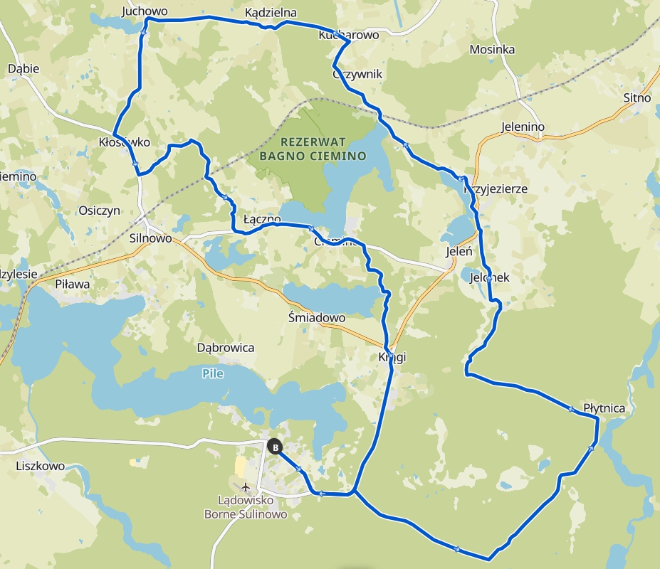
The route of the trail: Borne Sulinowo – Lake Przełęg – Jelonek – Jeleń – Przyjezierze – Grabno – Lake Ciemino – Kucharowo – Kucharowskie Hill – Kądzielnia – Juchowo – Kłosówko – Land of Eternal Oaks – Łączno – Lake Ciemino – Ciemino – Lake Śniadowo – Krągi – Borne Sulinowo.

The length of the trail is 53.3 km.

The "Nad Jezioro Ciemino" bike trail is marked with a white square with a black silhouette of a bicycle in the upper half and a red rectangle in the lower half. Before the change of direction, instead of a rectangle, there is a red arrow pointing in the right direction.

The trail's starting and ending points are marked by a white square with a red circle in the center. The trail is marked in two directions, allowing you to cycle in the order of the photographs or in the opposite direction.

The red bicycle trail “To Lake Ciemino” begins and ends at the junction of three municipal bicycle trails in a tree-lined square, next to a glacial erratic – a monument in front of the town hall in Borne Sulinowo.

It traverses the variably configured main lake system of the Drawsko Lake District. It brushes the shores of the extraordinary Lake Ciemino twice and passes through the forgotten Land of Eternal Oaks.

Lakeside Dark Red Bike Trail

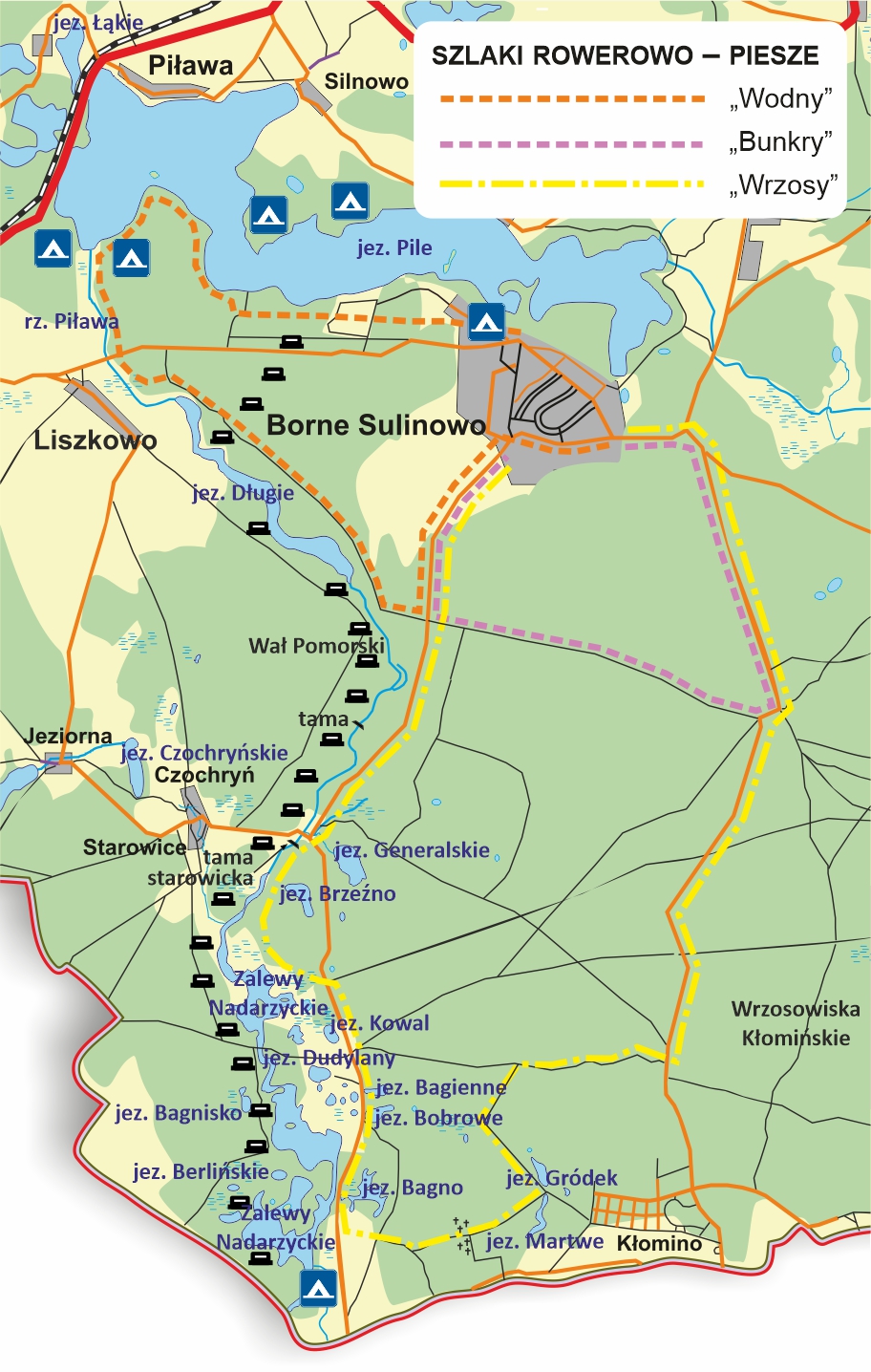
BICYCLE AND HIKING TRAILS OF THE BORNE SULINOWO FOREST DISTRICT

"Water" (orange trail) – 16.5 km
It begins and ends at the Borne Sulinowo Forest District headquarters and runs along the shores of Lakes Pile and Długie.

"Bunkers" (pink trail) – 12 km
It begins and ends at the Borne Sulinowo Forest District headquarters and runs through the former Soviet military training grounds.

"Heather" (yellow trail) – 35 km
It begins and ends at the Borne Sulinowo Forest District headquarters. It passes through a former Soviet military training ground. The trail includes the Kłomińskie Heathlands, the Nadarzyce Reservoirs, and the Piława River Valley.

Borne-Sulinowo-municipality-forest district trails (1)

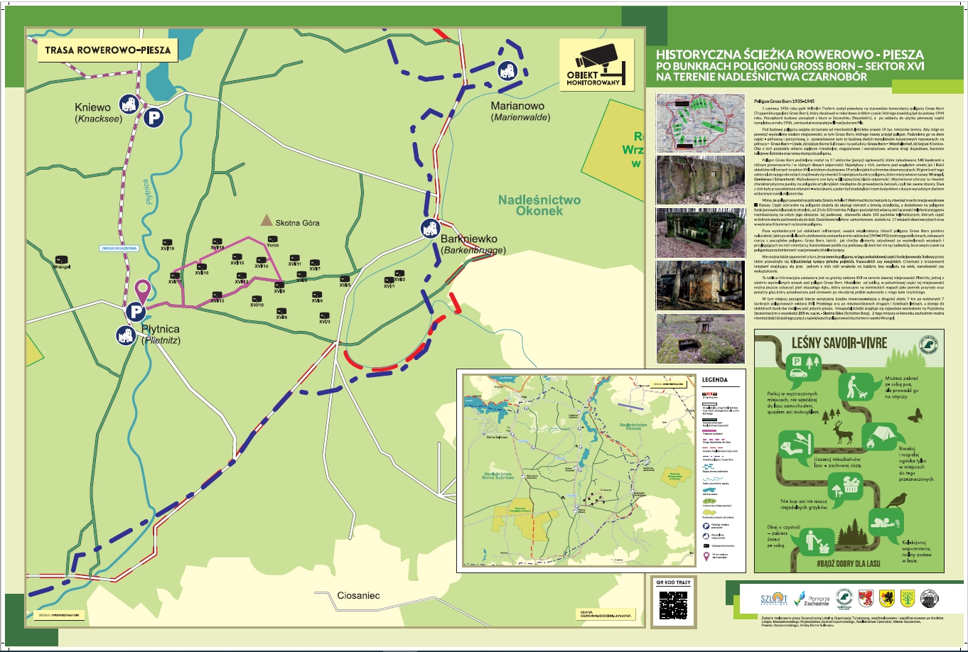
HIKING AND CYCLING PATH - THROUGH THE BUNKERS OF THE GROS POLISHING GAME

A hiking and cycling trail, "Around the Bunkers of the Gross Born Military Training Area," has been created within the Czarnobór Forest District. Ten bunkers are open to the public to explore examples of the military facilities at the Gross Born Military Training Area. Three of these are individually accessible facilities. The remaining seven are selected, best-preserved bunkers from Sector XVI, located on a designated cycling and hiking trail approximately 7 km long.

The route begins at the parking area by the Płytnica River, on a forest road open to vehicle traffic (fire access road no. 35). The route follows unpaved roads and forest paths. Some bunkers require walking.

board-trail-bunkers

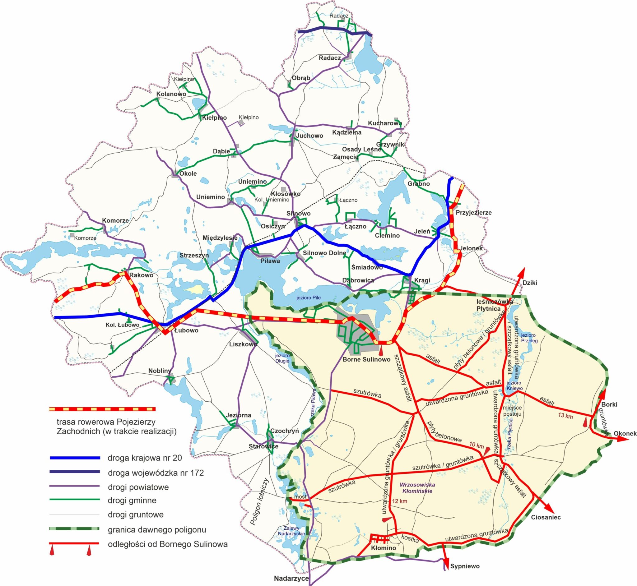
PAVED ROADS ON THE FORMER TRAINING GROUND

paved-roads-on-the-former-military-area-scaled-1-2048x1885

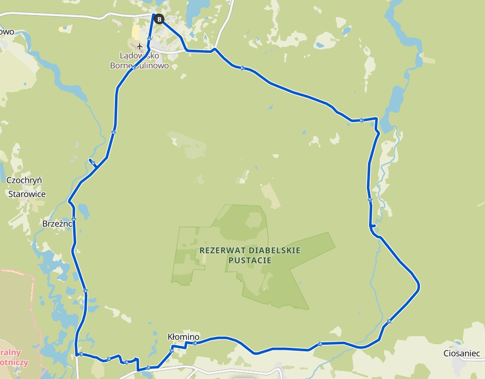
TRAIL AROUND THE TRAINING GROUND

This challenging gravel route requires a good level of fitness. Some sections of the hike may require walking the bike.

The route length is 43.6 km.

Types of surfaces:

  • unpaved: 14.4 km
  • compacted gravel: 3.66 km
  • paving stones: 3.82 km
  • paved: 1.69 km
  • asphalt: 20.0 km
trail-around-the-training-ground

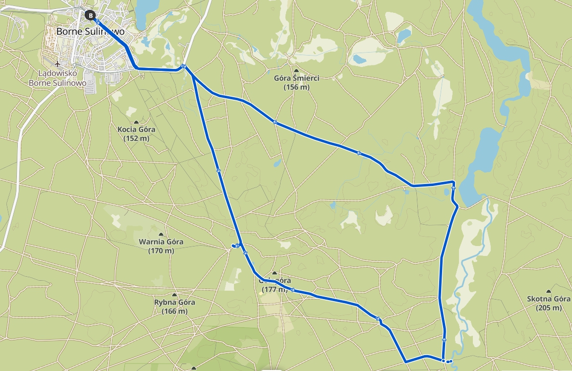
TRAIL OF ANCIENT SETTLEMENTS

A moderately difficult route. Suitable for all fitness levels. Some sections of the hike may be difficult to navigate due to unpaved roads.

The route length is 25km.

Types of surfaces:

  • unpaved: 2.00 km
  • compacted gravel: 3.23 km
  • paving stones: 3.27 km
  • paved: 4.62 km
  • asphalt: 11.8 km
trail-of-ancient-settlements

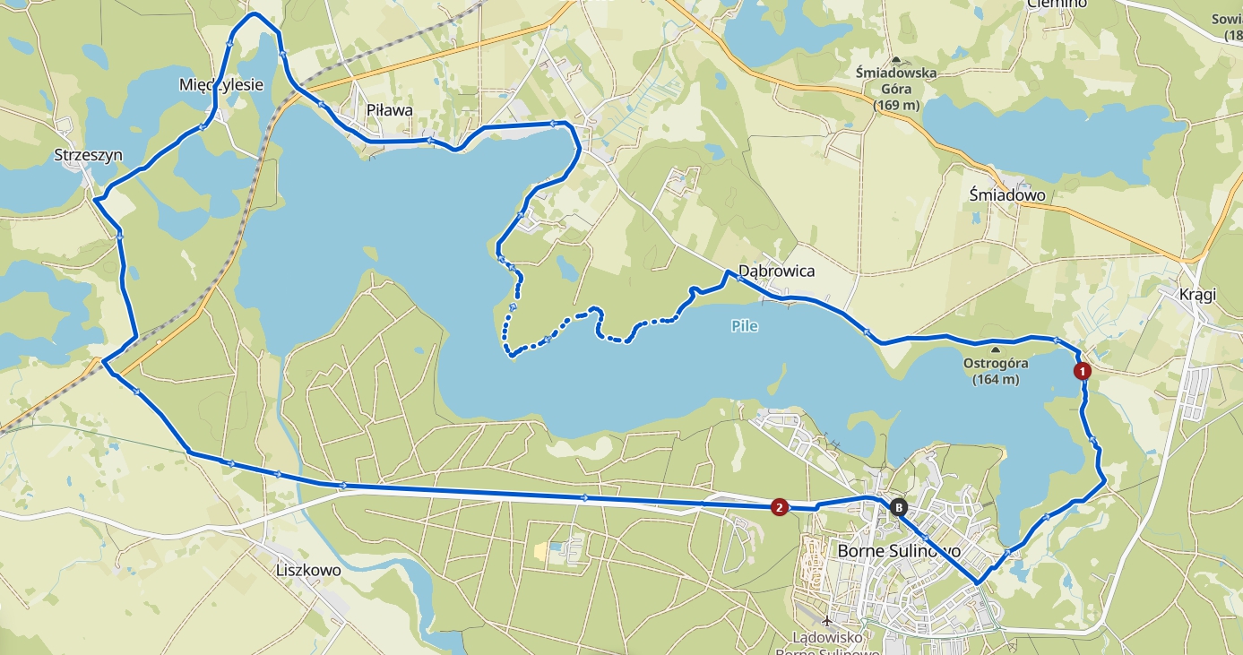
TRAIL AROUND LAKE PILE

A moderately difficult MTB trail. Suitable for all fitness levels. Advanced experience required.

The route length is 29 km.

Types of surfaces:

  • natural: 2.87 km
  • unpaved: 2.24 km
  • gravel: 3.44 km
  • paved: 6.82 km
  • asphalt: 10.6 km
  • no information: 3.03 km
trail-around-pile-lake

Source: it.bornesulinowo.pl